The Jura High Altitude Trail, also called Jura Crest Trail, is considered a classic among Switzerland’s long-distance trails. The trail follows the Jura Mountains in an arc from German-speaking northern Switzerland to the French-speaking west. It starts in Dielsdorf, just north of Zürich, and ends near Genève at the Lac Léman.
The Jura High Altitude Trail is 310 km long. Its lowest point is 320 m above sea level [near Brugg], the highest point 1’680 m [Mont Tendre]. Walking from end to end takes about 2 weeks.
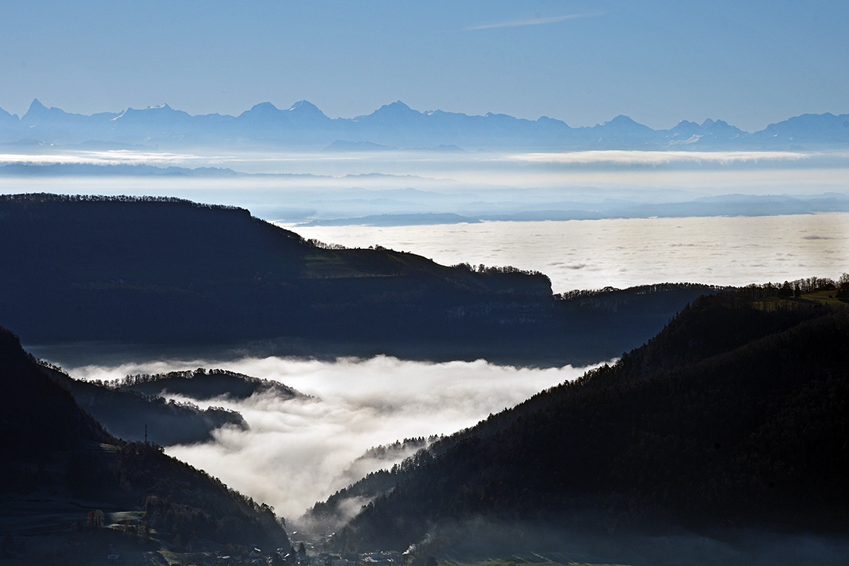
The vistas from Passwang summit (Vogelberg 1’204 m) were spectacular, with the whole Swiss Plateau (Mittelland) laid out southwards and the spectacular alpine panorama lined up beyond.